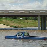
Predicting Floods

There are two basic kinds of floods, flash floods and the more widespread river flooding. Flash floods generally cause greater loss of life and river floods generally cause greater loss of property. A flash flood occurs when runoff from excessive rainfall causes a rapid rise in the stage of a stream or normally dry channel. Flash floods are more common in areas with a dry climate and rocky terrain because lack of soil or vegetation allows torrential rains (typically from summer thunderstorms) to flow overland rather than infiltrate into the ground.
River flooding is generally more common for larger rivers in areas with a wetter climate, when excessive runoff from longer-lasting rainstorms (such as from a cold front) and sometimes from melting snow causes a slower water-level rise, but over a larger area. Floods also can be caused by ice jams on a river, or high tides. Most floods can be linked to a storm of some kind. The National Weather Service collects and interprets rainfall data throughout the United States and issues flood watches and warnings as appropriate. The National Weather Service uses statistical models and flood histories to try to predict the results of expected storms. The USGS maintains a network of streamflow-gaging stations throughout the country for which the discharge and stage are monitored. Flood estimation maps are generally produced by estimating a flood with a certain recurrence interval or probability and simulating the inundation levels based on flood plain and channel characteristics.
Fact Credit
USGS General


